.


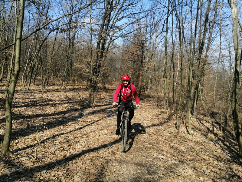
We present you seven hiking trails in Kraljevo for hiking beginners. They are arranged from the easiest to the hardest so you can ideally prepare for more serious mountaineering challenges. While visiting these trails, you will discover the hidden gems of our mountains and enjoy the stunning viewpoints over the city and surroundings. All seven trails are recreational, without dangerous terrains and steep cliffs which require climbing skills and using hands. Even though the trails are shorter, it is necessary to truthfully evaluate your form and physical fitness before you visit them. Speed walking and running few times a week is the best way to improve your fitness. We wish you a safe and enjoyable visit!
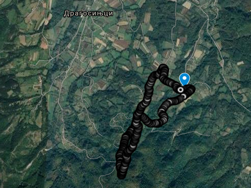
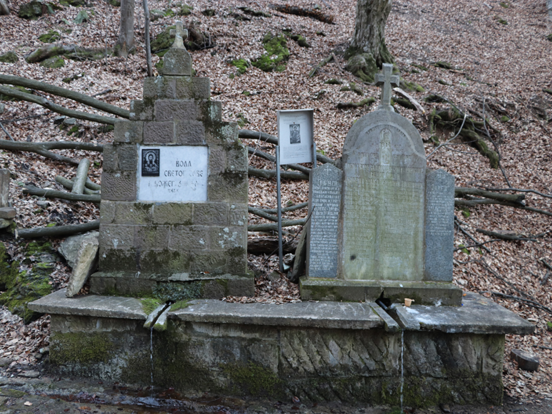
1. Saint Sava spring at Dragosinjci village
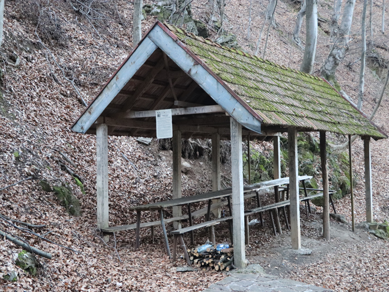
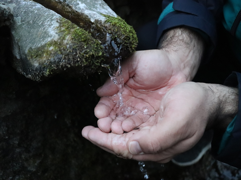
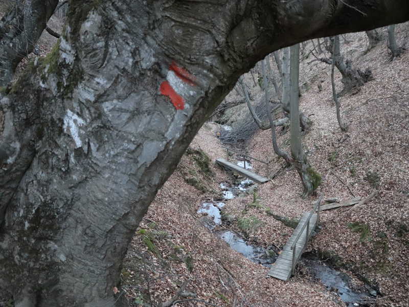
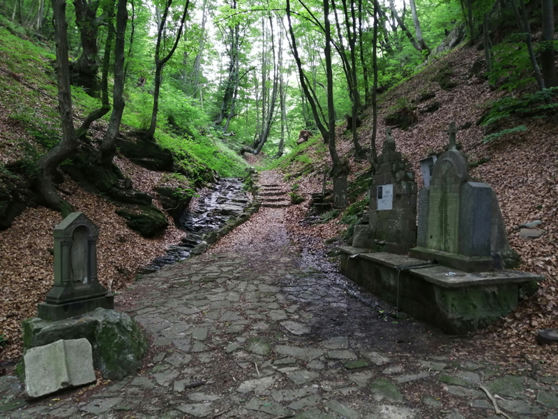
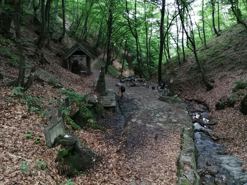
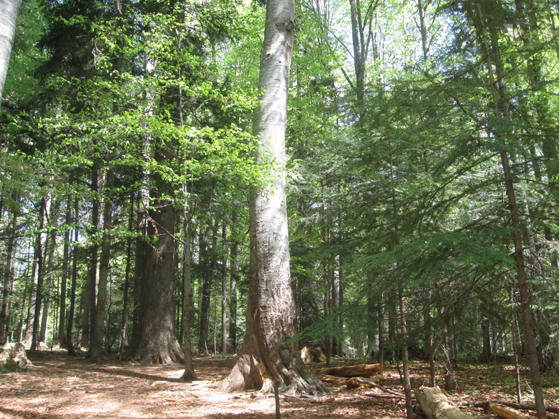
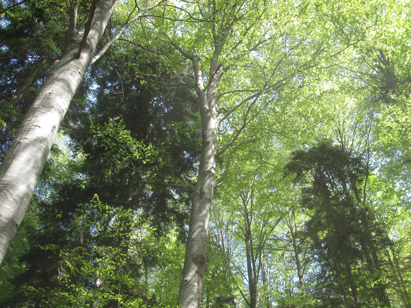
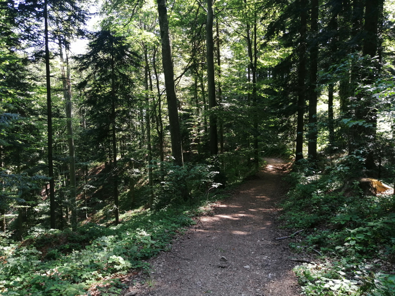
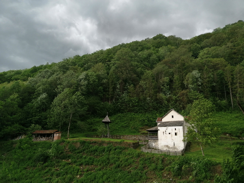
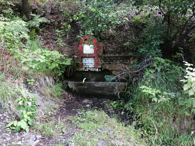
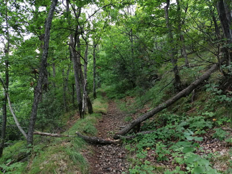
Dragosinjci village is located at the northern foothills of Goc Mountain and it has around 250 houses. Villigers believe that the village existed in the time of Saint Sava, who reportedly said ‘’Dragosinjci, my sons’’ and ‘’Otroci, my fathers’’ on the way from Zica to Gracac village. For Sava water, as they call it here, many believe it is healing water. Thanks to the hardworking locals, spring is fixed up with five fountains and huge covered bench with a big table. This place is visited every 27th of March within the event of ‘’Saint Sava days in Kraljevo’’. Not far away from here at the Strazba place, Saint John`s ‘’autumnal’’ convocation (29th of August) is being held and it is visited by many people from the village and the region. The spring is located at beech tree forest with very little sunlight, so the place appears rather mystical and photogenic. The walking trail is mostly in the shade and the gravel roads leads to a narrow path at the end. There is a small stream with interesting cascades passing next to the spring. It is not easy to find a road to the spring, so using this circle GPS track will help you find it. Parking places close to the spring are also pretty limited so you will definitely love this easy walk.
Trail length: 4,5 km Total altitude gain / total ascent: 200 m Starting altitude: 315 m Max. altitude / elevation: 500 m Starting point coordinates: N 43.664247; E 20.748375 Distance from hiking trail to the city centre: 11 km
Тrack view Saint Sava spring at Dragosinjci village
Download .GPX file Download .KML file
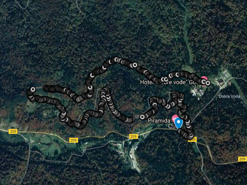
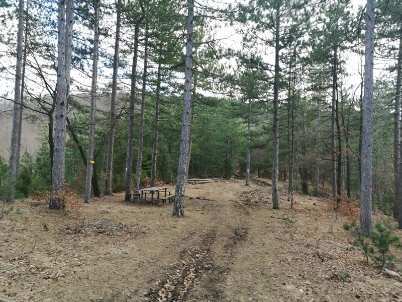
2. Yellow trail at Goc Mountain
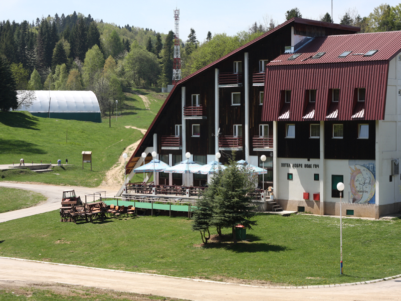
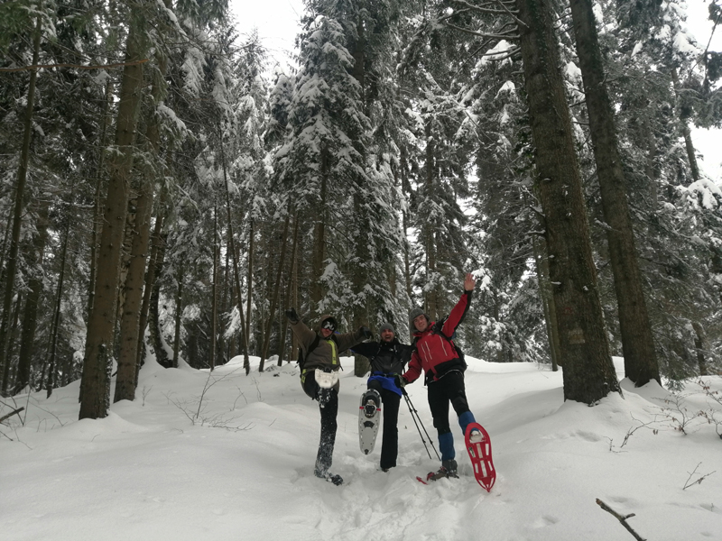
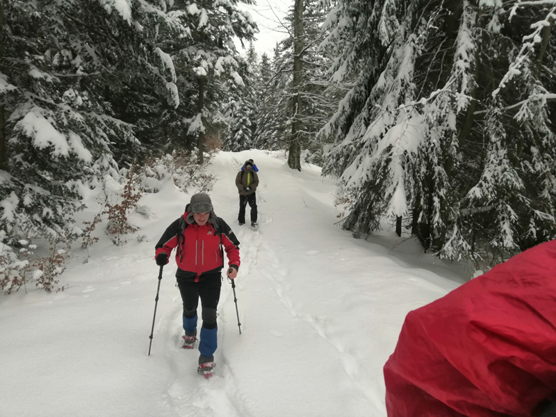
Goc mountain is located between Kraljevo and Vrnjacka Spa and it appears as it is waving to Zapadna Morava with its indigenous trees of Serbia, it is following its flow. Forest mosaic of old trees of beech and spruce, with pines, oaks, maples and 600 other plants represents the symbol of the mountain and lungs of the surrounding cities. It is just one of the reasons why this natural treasure has the status of protected area from 2014 with four thousand hectares under protection. The round trail which we present is located within the protected area and matches the two well known hotels – Piramida with Dobre Vode, so either of these two spots could be the starting point of your hike. Students of the Faculty of Forestry from Belgrade come here every year to learn about and practice sustainable forestry management. Furthermore, many children from Serbia come here during the year on the program of school in nature. The trail is 5 km long and the elevation is around 1000, which is ideal for recreation and recovering from urban life. This trail is wonderful for summer visits because it passes through the deep forests, but it is especially stimulating to visit it in winter with snowshoes too!
Trail length: 4,7 km Total altitude gain / total ascent: 270 m Starting altitude: 930 m Max. altitude / elevation: 995 m Starting point coordinates: N 43.562477; E 20.758357 Distance from hiking trail to the city centre: 31 km
Тrack view yellow trail at Goc Mountain
Download .GPX file Download .KML file
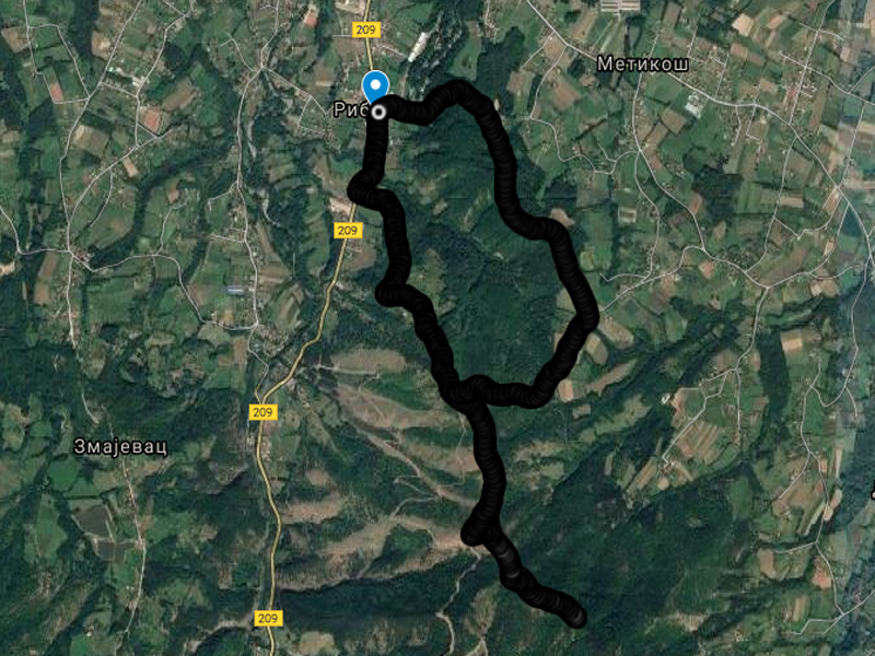
3. Round trail to Cava peak
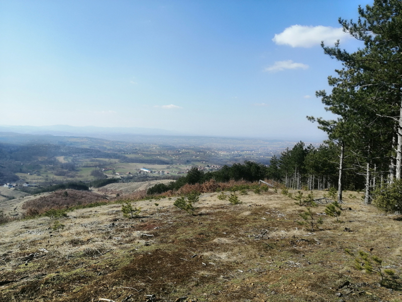
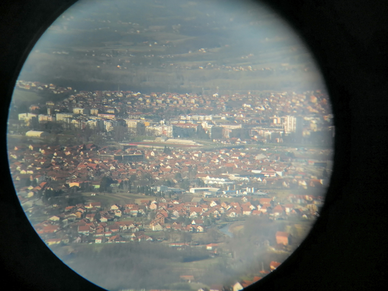
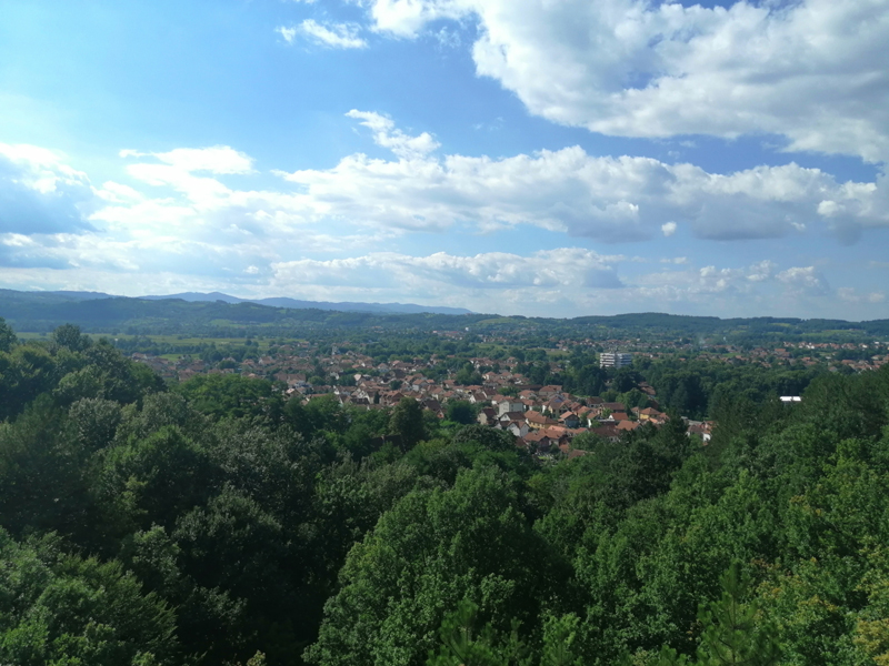
The most visited peak by the citizens of Kraljevo is probably Cava, which is located just 7 km from the city centre. It presents a training ground for local mountaineers, cyclists, athletes, enduro and quad drivers… This place belongs to northern slopes of Goc Mountain. The trail starts from the main Kraljevo – Brezna road and soon climbs up the northern slopes towards the peak. Most of the trail is a gravel road. There are no water sources on the trail. Unfortunately, 10 years ago at this place, there was a large forest fire caused by man negligence, and over 40 hectares of pine forest was burned. These hills, which are visible from the city, should be a lesson for all upcoming generations to leave nothing behind when visiting nature and preserve the forest from fire. Peak is located between Metikos and Ribnica villages. Bring binoculars with you. The mountain top offers a scenic view of Sumadija Mountains, Stolovi, Troglav, Zapadna Morava valley and the city of Kraljevo…
Trail length: 8 km Total altitude gain / total ascent: 340 m Starting altitude: 230 m Max. altitude / elevation: 545 m Starting point coordinates: N 43.688512; E 20.699099 Distance from hiking trail to the city centre: 5 km
Тrack view round trail to Cava peak
Download .GPX file Download .KML file

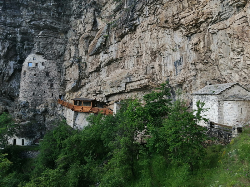
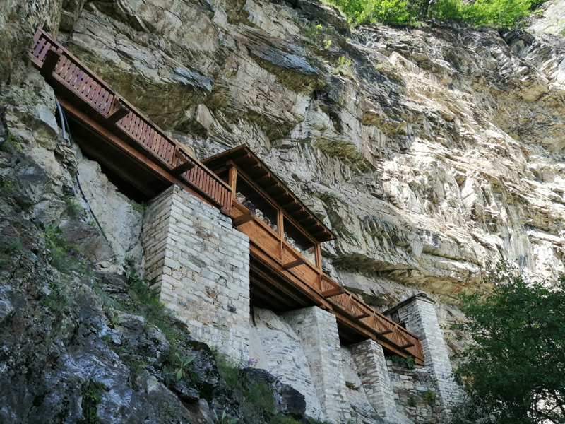
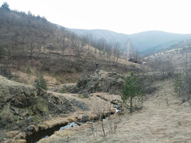
4. Hermitage of Saint Sava
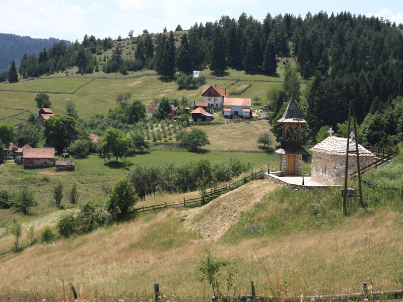
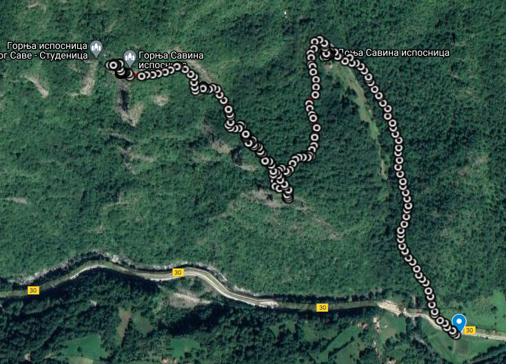
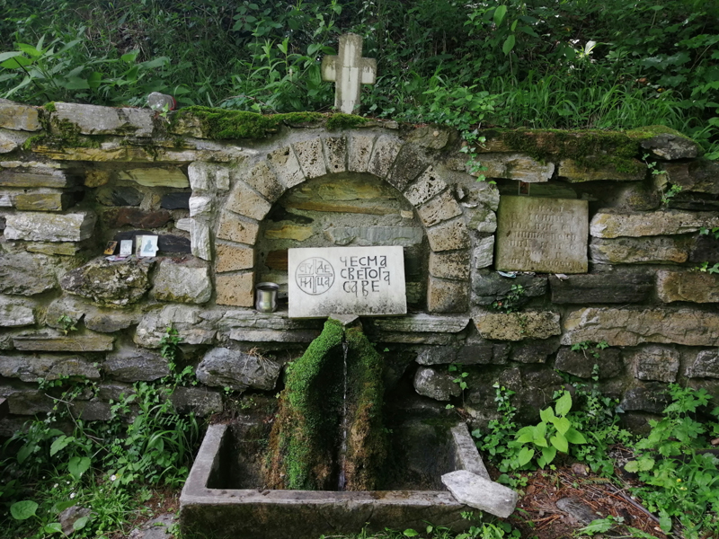
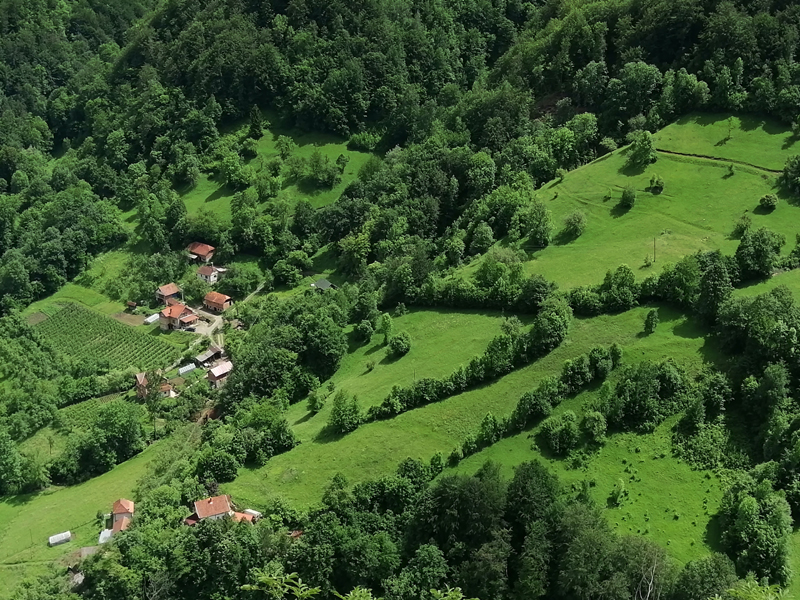
Cemerno Mountain is forgotten at the mountaineering maps of Serbia even though it was a venue for important historical events from the period of Saint Sava when he built the Hermitage and wrote Studenica typicon untill the heroic battles of the Great War. This short pilgrimage starts from the main road which connects Usce on Ibar river with Ivanjica municipality, at the eighth kilometre from Studenica monastery upstream the Studenica river. A narrow trail leads by steep southern slopes of the mountain through oak and hornbeam forests. First stop is usually the Lower Hermitage with Saint Sava drinking water fountain. The trail goes further above Lower Hermitage about 200 m strait then turns zigzag uphill. At several points there are signals and benches. About an hour of easy walking without breaks is enough to reach ‘’home of silence’’ – Upper Hermitage of Saint Sava. At the moment of publishing this text the hermitage is open and active. Monks from Studenica Monastery are taking care of it. Visit this place in peace and silence. First village, Savovo, is located in the extension of the trail uphill, but that one we will present some other time. Even though these villages are sparsely populated, you can still hear the song ‘’Hey Cemerno, green meadow’’. You can go back by the same way. Don’t miss a chance to visit Studenica Monastery and Tree of love in the near surroundings.
Trail length: 2,5 km Total altitude gain / total ascent: 530 m Starting altitude: 545 m Max. altitude / elevation: 935 m Starting point coordinates: N 43.31132; E 20.28480 Distance from hiking trail to the city centre: 67 km
Тrack view hermitage of Saint Sava
Download .GPX file Download .KML file
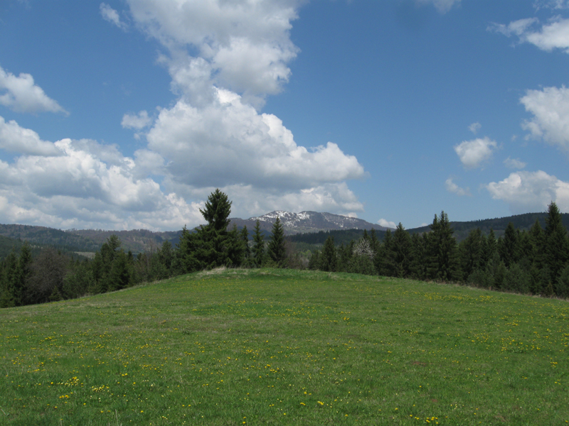
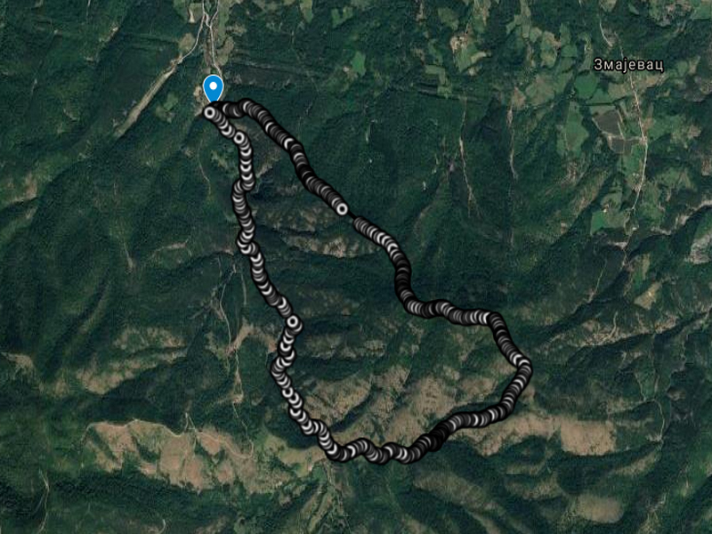
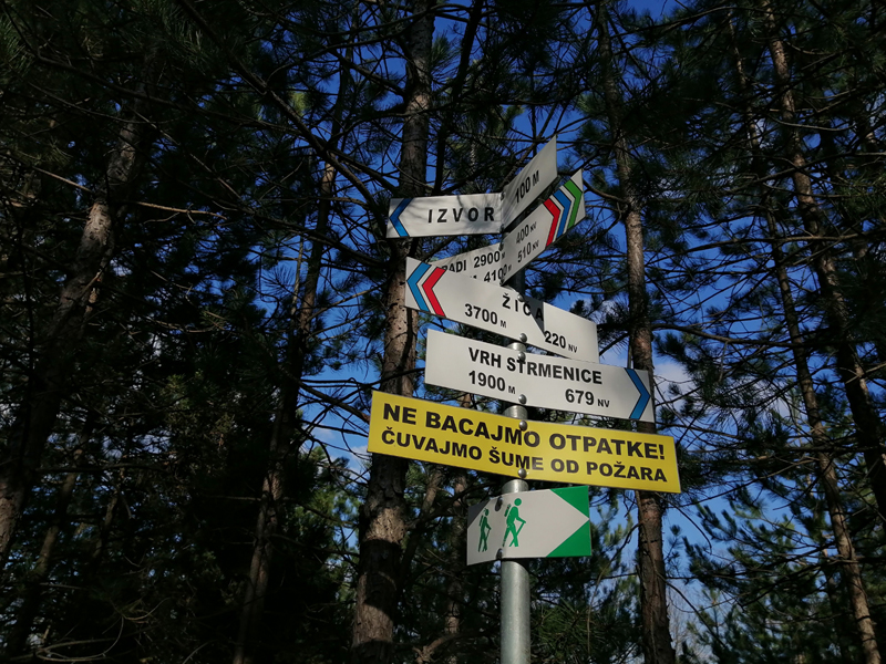
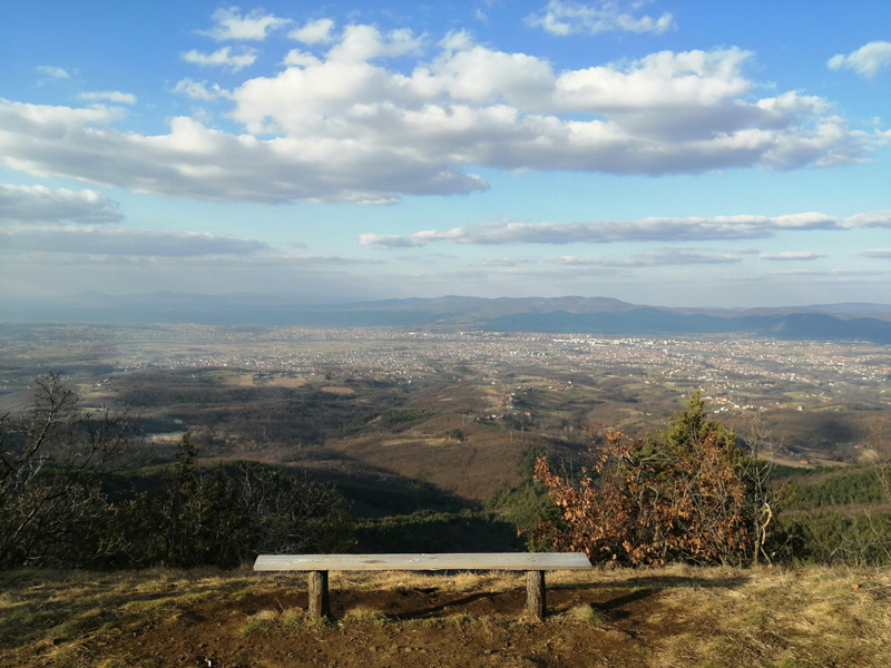
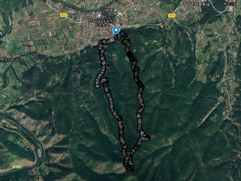
5. Blue trail to Strmenica peak
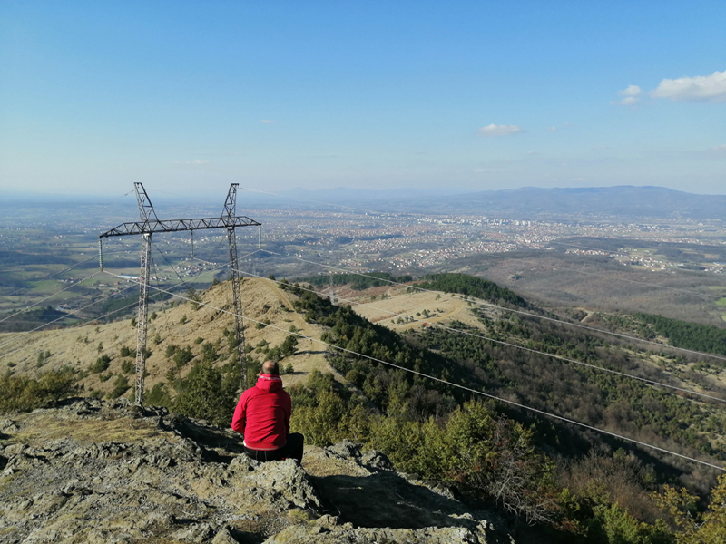
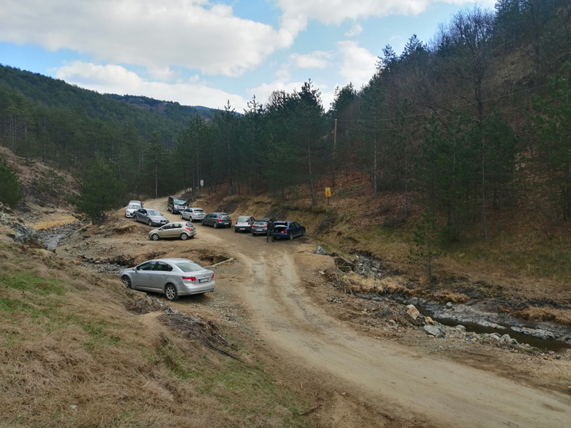
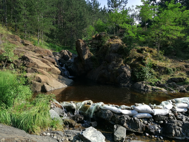
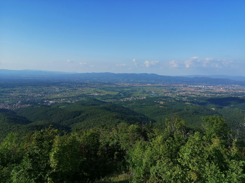
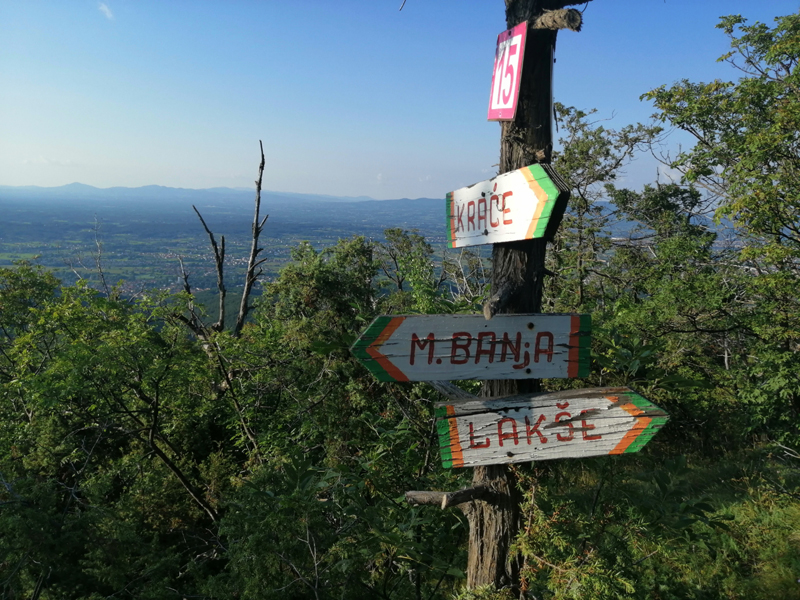
Strmenica (679 m) is also one of peaks easily reachable from the city centre and it is also frequently visited. Here, at the northern slopes of Stolovi mountain, tourist signalization in several different colours has been set up. You will find the starting point of this trail by following Zicka river. At the starting point you can find info table with hiking trails and mentioned signalization. The round trail we recommend is marked by blue and white colours. Even though there are fountains with drinking water at the trail and in the households near the start, we recommend to bringing at least 1l of drinking water with you. There are a few resting places with benches on the trail too. The advantage of this trail is the fact that you can cut it turning to the right by green, yellow or red trail which goes back to the gravel road which takes you to starting point of the trail. As you go further more to the peak, the view of the city and surrounding mountains is more beautiful. The trail goes mainly through the pine forests. Just before you reach the peak, there is a beautiful viewpoint with a small bench and probably the best view of the city of Kraljevo. The trail goes further towards Gradi village and back to Zicka river. The narrow trail follows the contributories of Zicka river through amazing landscapes where you don’t get the feeling that you are just 15 min drive away from the city centre. On the way back to the city in summer, besides Zica monastery visit, we recommend you visiting one of the natural pools if Zicka river. The most famous one is Ratkov pool.
Trail length: 7,8 km Total altitude gain / total ascent: 430 m Starting altitude: 300 m Max. altitude / elevation: 679 m Starting point coordinates: N 43.670113; E 20.6455486 Distance from hiking trail to the city centre: 8 km
Тrack view blue trail to Strmenica peak
Download .GPX file Download .KML file
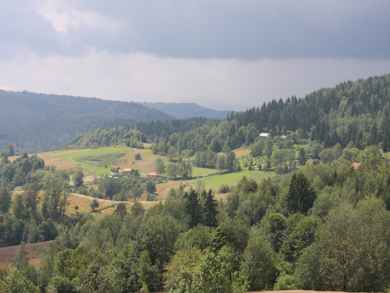
6. Petrified forests - Lojanik
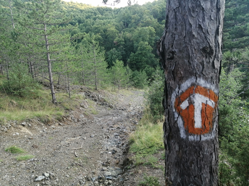
Petrified forest – Lojanik is a rare locality site of palaeobotanical character with fossil remains of petrified wood. In addition, it is one of the oldest prehistoric opal mines in the central Balkans. It is located on the northern slopes of Stolovi Mountain, and the easiest way to reach the site is from Mataruska spa by a hiking trail. Besides Lojanik, this hiking trail takes you to Ostra Glavica peak form wich there is a crystal clear view of Kraljevo as well as the valley of West Morava river towards Cacak city. The extensive network of hiking trails in this part of Stolovi Mountain and beyond was traced and marked by the famous local mountaineer Branislav Binic – Bine, honorary citizen of the city of Kraljevo. For the ascend we recommend you take the left side looking towards the mountain. The starting point is the main bus station in the Mataruska spa. The trail follows Hajduk Veljko Street, than gravel roads marked with standard red and white mountaineering signalization. After one kilometer from the bus station you will come across the remains of petrified woods in the stadium of semiprecious stones. If you are not ready to hike along the whole route, you can easily go back the same way. There is one drinking water spring on the trail. You are going to be delighted with the view from Ostra Glavica peak. Downhill is steep at the beginning and it is marked by orange and white tourist signalization.
Trail length: 8,3 km Total altitude gain / total ascent: 540 m Starting altitude: 240 m Max. altitude / elevation: 728 m Starting point coordinates: N 43.688880; E 20.615126 Distance from hiking trail to the city centre: 9 km
Тrack view petrified forests - Lojanik
Download .GPX file Download .KML file
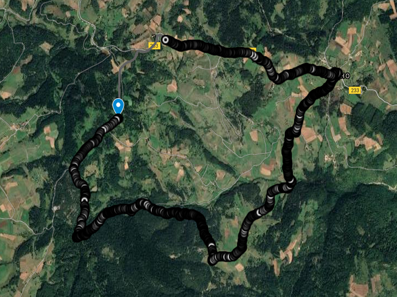
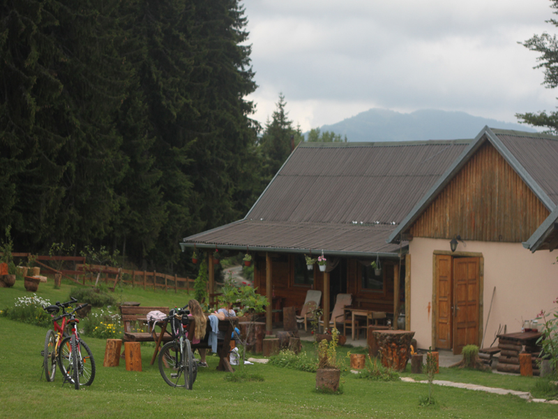
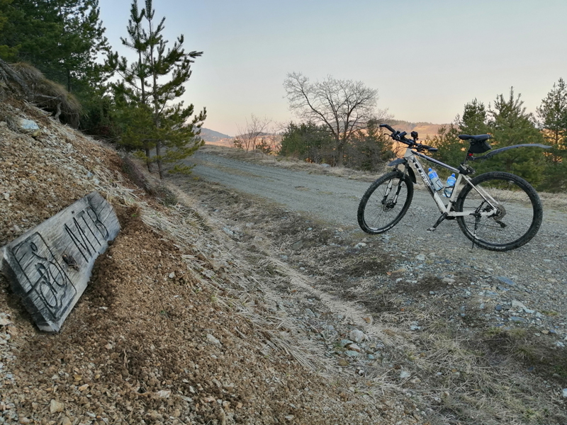
7. Studenac trail at Rudno village
This circle trail was marked by MTB club Ciker from Kraljevo with the help of locals and within the cross border project between Montenegro and Serbia in 2012. Although designed for MTB cyclists, it is ideal for hiking beginners. It is about 12 km long with cumulative ascend of about 400 m. The rolling hill terrains of Rudno plateau will not leave you indifferent nor the rural accommodation hosts who have been working here with success for long time now. Over 70 % of the trail are gravel roads with poor traffic and good quality. Starting point is the centre of the Rudno village. You can find a table with the terrain profile and basic information. The trail goes by old households and nice viewpoints where you can enjoy the view on Radocelo peak and it`s beautiful surroundings. At the famous Srnjaca hill, in the household of Pansion Nebo, you can fill in your water bottles and have a small break. Spruce and pine forest interchange with endless meadows and pastures full of fungi and herbal plants. From Radova Voda site and from Dzode village you will be able to see a beautiful panorama of Rudno village with scattered households and fields of potatoes, raspberries and buckwheat. You should have in mind that in the moment of publishing this text tourist signalization is not enough to find the way, so following GPS track or hiring a licensed mountain guide is more than needed. Network coverage is also poor in some places. It is also good to know that snow stays here till late April usually, but in May is not a surprise too. After you visit this trail, you will fall in love with Golija which has widespread network of gravel roads and mountaineering trails which await you.
Trail length: 11,6 km Total altitude gain / total ascent: 370 m Starting altitude: 1115 m Max. altitude / elevation: 1265 m Starting point coordinates: N 43.414136; E 20.484272 Distance from hiking trail to the city centre: 95 km
Тrack view Studenac trail at Rudno village
Download .GPX file Download .KML file